Fort Lauderdale Hollywood International Airport (FLL)
Orientation and Maps
(Fort Lauderdale, Florida (FL), USA)
Much, much more than just a popular spring-break destination, Fort Lauderdale has undergone tremendous change is recent years and has truly reinvented itself. Fort Lauderdale is a major holiday destination all through the year and its main attractions include numerous nightclubs, bars, restaurants, marinas, countless historical sites and some glorious stretches of golden sand.
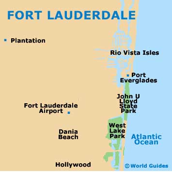
Those flying into this part of Florida often choose the Fort Lauderdale Hollywood International Airport (FLL), which stands directly south of the downtown district, close to the Port Everglades Junction where the I-95 meets the I-595. The city's train station is also extremely popular and is situated along the SW 21st Terrace, with services operated by both Amtrak and Tri-Rail.
Fort Lauderdale Hollywood International Airport (FLL) Maps: Important City Districts
Regular Greyhound buses travel to and from Fort Lauderdale's bus station on NE 3rd Street at Federal Way, connecting many other major cities in Florida, such as Miami, Orlando and also Tampa. Local BCT buses travel around the city and connect the main beach areas, with the Central Bus Terminal standing on NW 1st Avenue. A free TMAX minibus connects much of downtown Fort Lauderdale, operating every 15 minutes from Monday through Friday.
A good way to get a feel for the city of Fort Lauderdale is to take one of the extremely popular Water Taxis, which travel between the Las Olas Riverfront and also the Oakland Park Boulevard. Featuring commentary and scenic views along the way, inexpensive day passes are available.
USA Map
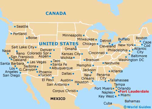
Florida Map

Fort Lauderdale Map